Lake Tikitapu
In ancient times, the daughter of a high born chief was bathing in its crystal waters and wore the Tikitapu (sacred greenstone neck ornament). The piece dislodged itself while she swam and the blue waters of the lake are believed to still be hiding the tikitapu.
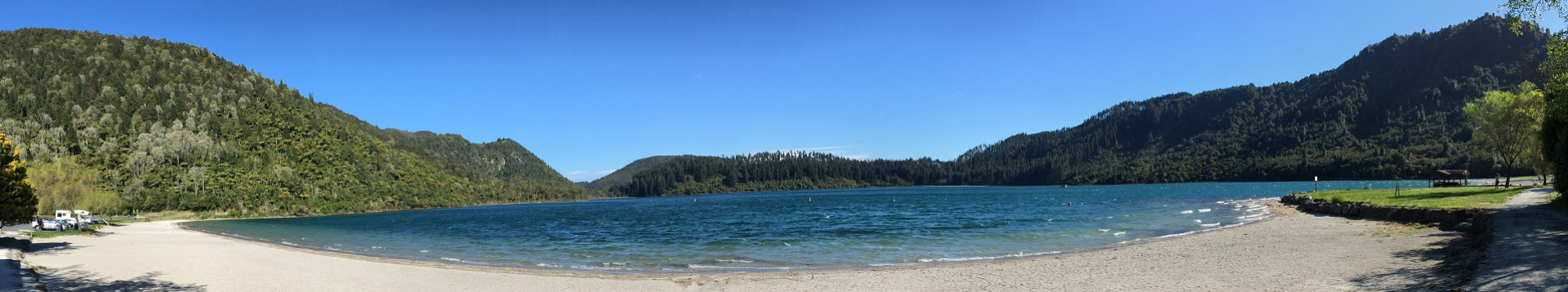
Lake Tikitapu is a small, circular lake framed by pretty native bush and forestry. Famous for its striking colour, it is commonly known as the Blue Lake and is adjacent to the slategreen coloured "Green Lake" / Lake Rotokakahi. With a water slide and an easy walking track around the lake, it is a popular location for family outings.
| At a glance | |
| Lake size: | 150 ha |
| Catchment area: | 570 ha |
| Elevation: | 415 m |
| Average depth: | 18 m |
| Deepest point: | 27.5 m |
| Formed: | 13,500 years ago |
| No surface outlet but probably drains via groundwater to Lake Rotokakahi |
Water Quality Status
All actions in the Action Plan have been completed for Lake Tikitapu. The lake almost reached its target in 2013 and continued the trend of improving water quality.
Catchment Map
Click here to view image of map.
Target and Results
To meet community expectations for Lake Tikitapu nitrogen inputs need to reduce by 800 kilograms and phosphorus by 30 kilograms.
|
Water Quality target |
2.7 |
|
2017 result |
2.6 |
|
2016 result |
2.9 |
Nutrient information
|
Nitrogen |
Phosphorus |
|
|
Total load |
2.5 Tonnes |
125 Kilograms |
|
Target |
1.7 Tonnes |
95 Kilograms |


Actions and achievements
Sewerage reticulation has provided the necessary nutrient reductions for Lake Tikitapu.
| Action | Target | Achieved as at June 2013 | Status |
| Sewerage reticulation |
700 kg N 70 kg P |
700 kg N 70 kg P |
Sewerage reticulation was completed in October 2010. |
Action Plan
Lake Action Plans direct what steps need to be taken to improve lake water quality to meet communitys' expectations.
Read Lake Tikitapu Action Plan
Science Research
|
Research Institute |
Report overview |
View |
|
University of Waikato |
A water quality model for Lake Tikitapu |
Report 1.74MB |